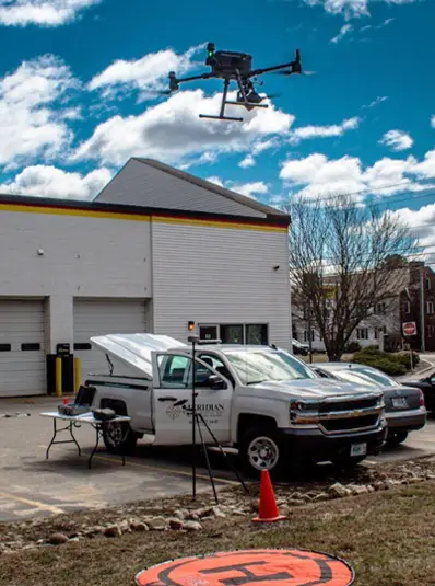
Advantages of LiDAR
How Drone LiDAR is Transforming Surveying in New Hampshire
Introduction: Why Surveying in New Hampshire is Uniquely Challenging
Surveying in New Hampshire presents a unique set of challenges that are not always found in other parts of the country. These challenges stem from a combination of regulatory structure, environmental conditions, and development constraints that make traditional data collection both time-consuming and complex.
Unlike many states that standardize requirements at the state level, New Hampshire gives significant authority to individual municipalities. Each town can have its own set of submission requirements, review processes, and development standards complicating things for those providing permitting services and project management. This means that surveyors and civil engineering teams must constantly adapt workflows depending on the project location, adding layers of complexity to even routine jobs.
On top of regulatory challenges, the natural environment plays a major role. New Hampshire is known for its dense forests, uneven terrain, and rugged landscapes. While these features contribute to the state’s beauty, they also create significant obstacles for NH land surveyors. Field crews executing surveys in NH often need to constantly reposition total stations due to limited lines of sight, navigate difficult terrain that slows productivity, and work in conditions where GPS signals are obstructed by heavy canopy cover.
Additionally, the state maintains a strong emphasis on environmental protection. Strict development regulations, wetlands protections, and permitting requirements mean that projects already face long timelines before construction can begin. They often require wetland delineations and additional land services. Even after field data is collected, projects must go through town submissions, state reviews, environmental approvals and various other permitting services.
Because of this, efficiency in data collection is no longer just a benefit, it is a necessity.
That raises an important question: how can New Hampshire surveyors maintain strict accuracy requirements while significantly improving efficiency?
The answer is clear: Drone LiDAR.
What is Drone LiDAR and How Does It Work?
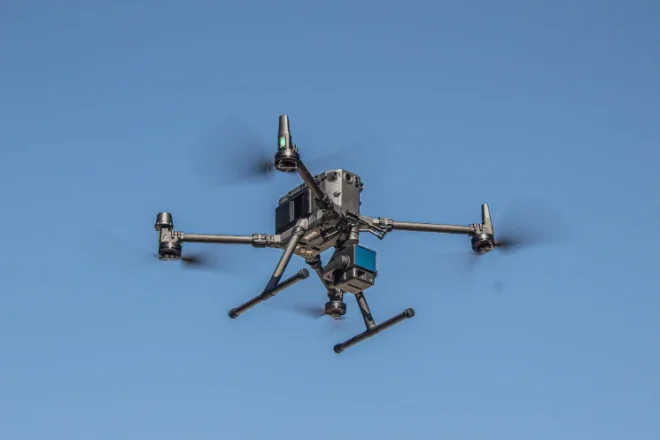
Drone LiDAR (Light Detection and Ranging) is one of the most powerful advancements in modern aerial surveying. By combining drone technology with high-speed laser scanning, LiDAR systems can rapidly collect extremely accurate three-dimensional data over large areas.
A drone-mounted LiDAR system emits hundreds of thousands of laser pulses per second toward the ground. Each pulse travels to the surface and reflects back to the sensor. By measuring the time it takes for each pulse to return, the system calculates precise distances.
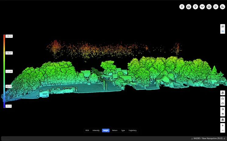
These measurements are then processed into a point cloud, which is a highly detailed three-dimensional representation of the surveyed area. Each point contains spatial coordinates and often additional attributes such as intensity or color.
The result is a dataset that can model terrain beneath dense vegetation, capture elevation changes with high precision, and provide a complete digital representation of a site. This makes drone LiDAR an ideal solution for aerial survey work in New Hampshire, where vegetation and terrain traditionally slow down field operations.
Why Drone LiDAR is Ideal for New Hampshire Surveying
Aerial Survey Allows Penetration Through Dense Vegetation
One of the biggest limitations of traditional surveying and photogrammetry is the inability to see the ground through tree cover. This creates major challenges for New Hampshire land surveyors collecting accurate terrain data through heavily forested areas.
LiDAR solves this problem. Because LiDAR emits laser pulses that can pass through gaps in vegetation, it can generate accurate ground points even in densely wooded areas. This significantly reduces the need for crews to physically traverse difficult terrain.
Reduced Field Time for Land services
Traditional survey methods often require days or even weeks of fieldwork for large or complex sites. Crews must move equipment repeatedly, cut lines of sight, and physically access all areas of the project.
With drone LiDAR, large areas can be captured in a single flight. Field crews can remain in safe, accessible locations while still collecting comprehensive data. This results in dramatically reduced field time and faster project turnaround. There are still elements of the project that will require boots on the ground. Boundary mapping and wetland delineation are not able to be interpreted off of LIDAR data alone.
For projects involving land surveying in New Hampshire, where regulatory timelines are already long, reducing field time can have a meaningful impact on overall project schedules.
Improved Safety
Surveying steep slopes or heavily wooded areas introduces safety risks for field crews. Drone-based aerial survey methods allow data to be collected remotely, minimizing exposure to hazardous conditions.
Crews can avoid unstable terrain, reduce time spent in remote areas, and still deliver high-quality results. This makes drone LiDAR not only more efficient but also significantly safer.
Consistency Across Projects
Drone LiDAR workflows provide consistent, repeatable results across a wide range of project types. This is especially valuable to New Hampshire land surveys, where each town may have different requirements. A standardized aerial survey approach helps ensure reliable data regardless of project location.
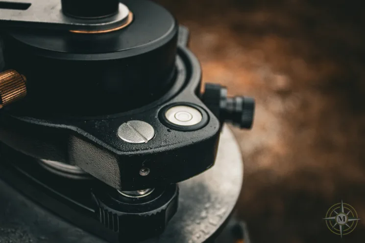
Maintaining Survey-Grade Accuracy with Drone LiDAR
A common concern when transitioning to aerial survey methods is whether accuracy can match traditional ground-based techniques. When proper workflows are followed, drone LiDAR can achieve survey-grade accuracy.
RTK and GNSS Positioning
Drone LiDAR systems use Real-Time Kinematic (RTK) GNSS technology to precisely track the drone’s position during flight. High-accuracy receivers onboard the drone communicate with a base station on the ground, which provides real-time corrections.
This ensures that all collected data is internally consistent and accurately positioned relative to itself. Measurements such as distances, elevations, and relative positioning within the dataset can be trusted.
Aerial Survey Ground Control Points (GCPs)
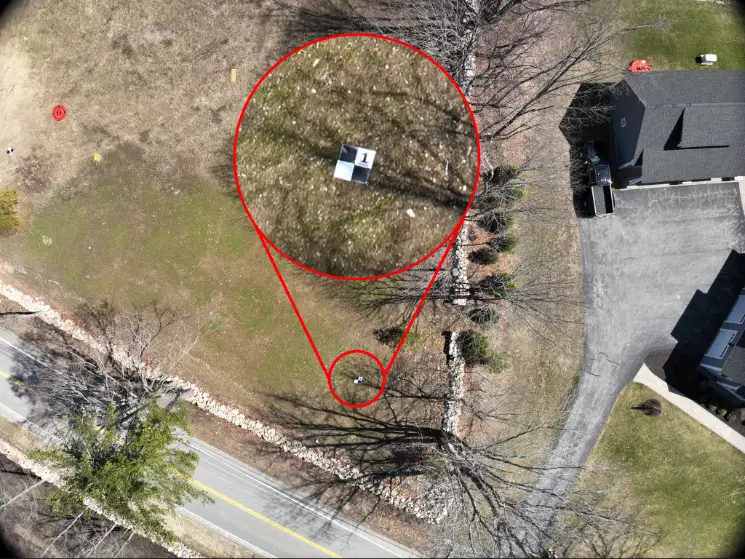
Ground Control Points are physical markers placed on the site and measured using high-accuracy survey equipment. Large targets that are clearly visible from the air are centered on top of the GCPs and used during processing to correct and align the LiDAR dataset.
By referencing GCPs, the point cloud can be adjusted to match real-world coordinates, ensuring that the entire project is accurately located within a known coordinate system.
Aerial Survey Check Points (CPs)
Check Points are used to verify accuracy after processing is complete. These points are measured in the field and have a visual target placed on top of them but are not used to influence the dataset during processing.
Instead, their locations are compared against the processed LiDAR data. By analyzing the difference between the surveyed position and the LiDAR-derived position, surveyors can quantify project error and confirm that the project meets required accuracy standards.
This combination of RTK positioning, Ground Control Points, and Check Points ensures that drone LiDAR surveys in New Hampshire meet the strict accuracy requirements expected in the surveying and civil engineering industries.
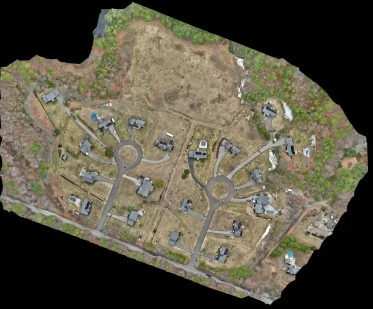
Applications of Drone LiDAR in New Hampshire
Drone LiDAR has a wide range of applications across surveying, engineering, and construction.
- Topographic surveys benefit from accurate terrain modeling. Engineers can generate contours, surface models, and site data much faster than with traditional methods.
- Utility and corridor mapping projects, such as power line surveys, can be completed more safely and efficiently. LiDAR allows for vegetation analysis and corridor modeling without requiring crews to access difficult terrain.
- Construction and site development projects benefit from faster existing conditions surveys, improved planning, and better data for tracking progress over time. Volumetric analysis and site monitoring can also be performed with high accuracy.
- Environmental and permitting efforts are supported through detailed terrain data and comprehensive site documentation. This can help streamline submissions and improve communication with regulatory agencies.
These applications highlight why drone LiDAR is becoming an essential tool for aerial survey work in New Hampshire.
The Importance of Drone LiDAR for New Hampshire Surveying
For those searching for New Hampshire drone survey services, LiDAR mapping in New Hampshire, or aerial survey companies in New Hampshire, the goal is typically the same: faster data collection without sacrificing accuracy.
Drone LiDAR provides a solution that balances speed, precision, and efficiency. By leveraging aerial survey technology, project teams can reduce field time, improve data quality, and accelerate project timelines.
As demand for high-quality data continues to grow, drone LiDAR is becoming a key component of modern surveying workflows throughout New Hampshire.
Conclusion: The Future of Surveying in New Hampshire
Surveying in New Hampshire will always involve unique challenges, from dense forests and rugged terrain to complex municipal requirements and strict environmental regulations.
However, the tools used to overcome those challenges are evolving.
Drone LiDAR represents a major advancement in how survey data is collected and processed. It allows surveyors and engineers to maintain the high levels of accuracy required in the industry while significantly improving efficiency and safety.
As projects continue to demand faster turnaround times and more detailed datasets, drone LiDAR surveying in New Hampshire will continue to grow in importance. Aerial survey and LiDAR technology are not just improving workflows—they are redefining what is possible in the field of surveying.